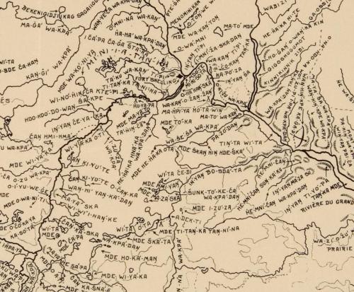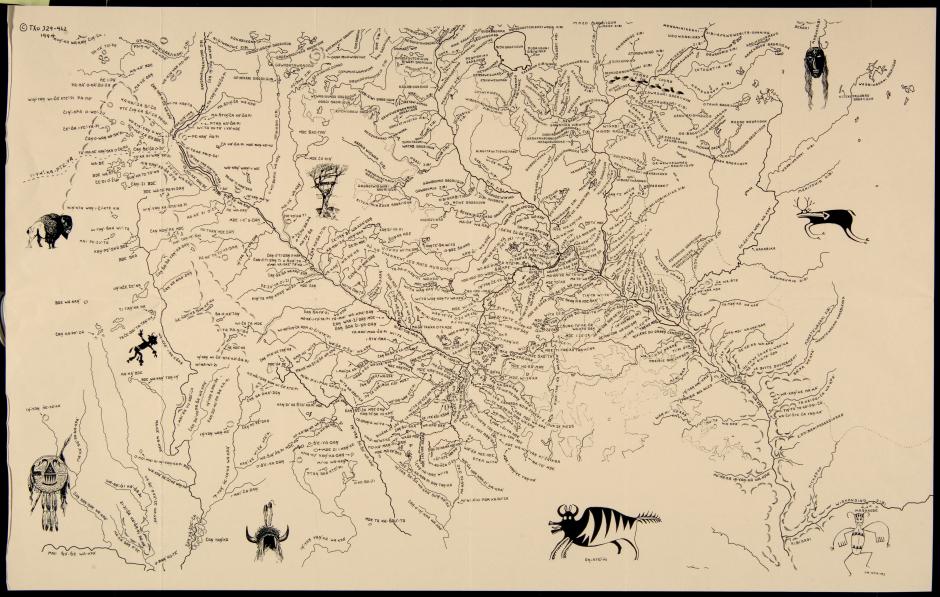
Paul Durand (1917-2007), who created this map, wrote, “The greater part of these place names has been gleaned from the field-notes and maps of Joseph Nicollet, commissioned in the 1830s by the US government to survey the Upper Missouri and Mississippi River basins.” It is a map of Dakota names for sites in the area that is current-day Minnesota.
About this map, Reverend Gary Cavender wrote:
“The writing of history, that which gets recorded, is almost always presented from the viewpoint of the dominant culture of the time. This is what occurred when the first Europeans arrived on the continent or the “New World” as it was called by them... It certainly wasn’t new to the ones who lived here; rather, it was an ancient and familiar place, a world with myths and beginnings and cycles --reasons why life is lived in a certain way. There were names of places that told what happened here, that described the center of the earth, or the war of the sky god and the god of the nether regions. Yes, this was certainly an old and active world. That was soon to change, however; the newcomers would change all that. They would put their names on these places. Their heroes would now identify these places and the ancient names would fade, soon to be forgotten. Where the Rivers Gather and the Waters Meet will not allow that to happen....It will preserve the past before American history began. Future generations will know there was a time before American history.”