
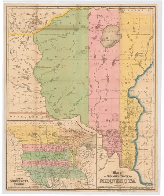
Map of the organized counties of Minnesota in 1850 by Thomas Cowperthwait & Company. Zoom in on the map.
The U.S. government created territories to impose order on vast areas of "unorganized" land. Indians owned most of the 166,000 square miles of land at the beginning of Minnesota's Territory period--and almost none of it at the end.
Minnesota became a territory in 1849. White settlers were eager to establish homesteads on the fertile frontier. Pressured by traders and threatened with military force, the Dakota were forced to cede nearly all their land in Minnesota and eastern Dakota in the 1851 treaties of Traverse des Sioux and Mendota.

