
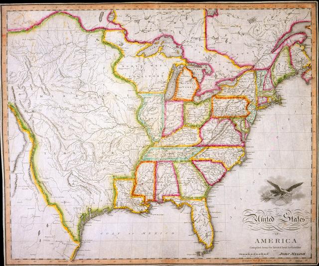
The map so constructed shows at a glance the whole extent of the United States territory from sea to sea; and in tracing the probable expansion of the human race from east to west, the mind find an agreeable resting place on its western limits. The view is complete, and leaves nothing to be wished for.
John Melish, 1819
John Melish, a Scottish-American mapmaker in Philadelphia, drew this map in 1819 as he envisioned the U.S. to be after expansion. It echoed U.S. hopes at the time. Military posts were constructed in the regions of expansion, many still occupied by Indigenous peoples, as the U.S. spread westward.

